 Image 1 of 7
 Image 2 of 7
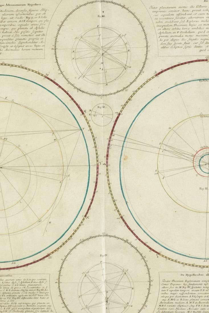 Image 3 of 7
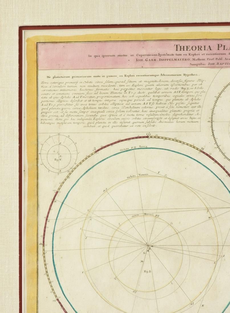 Image 4 of 7
 Image 5 of 7
 Image 6 of 7
 Image 7 of 7
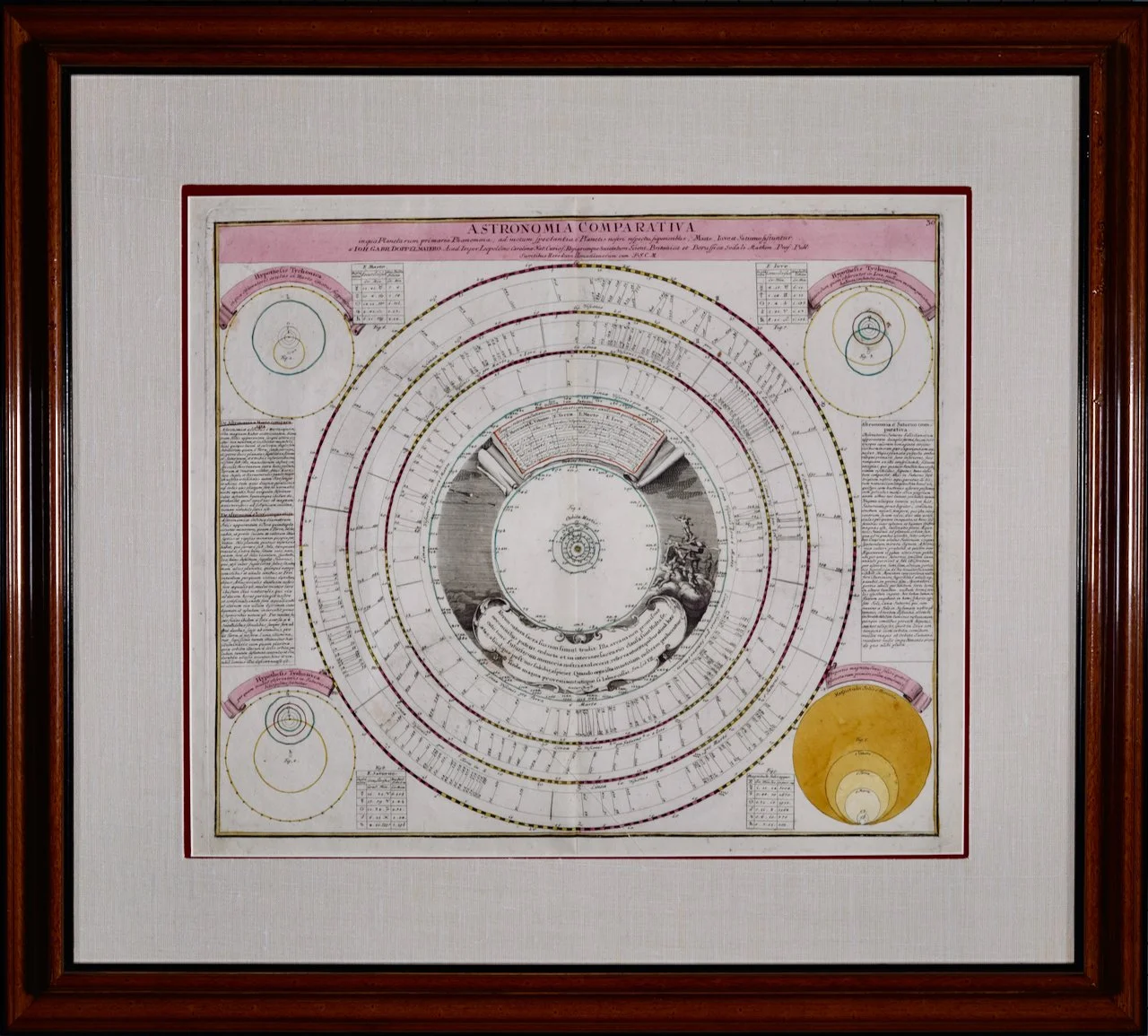
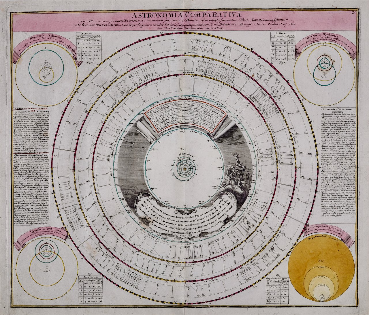
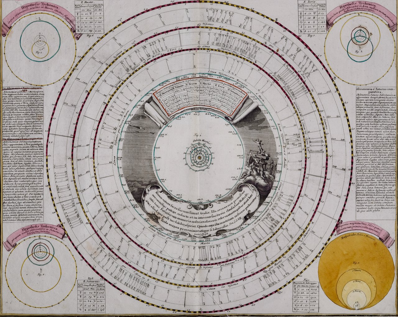
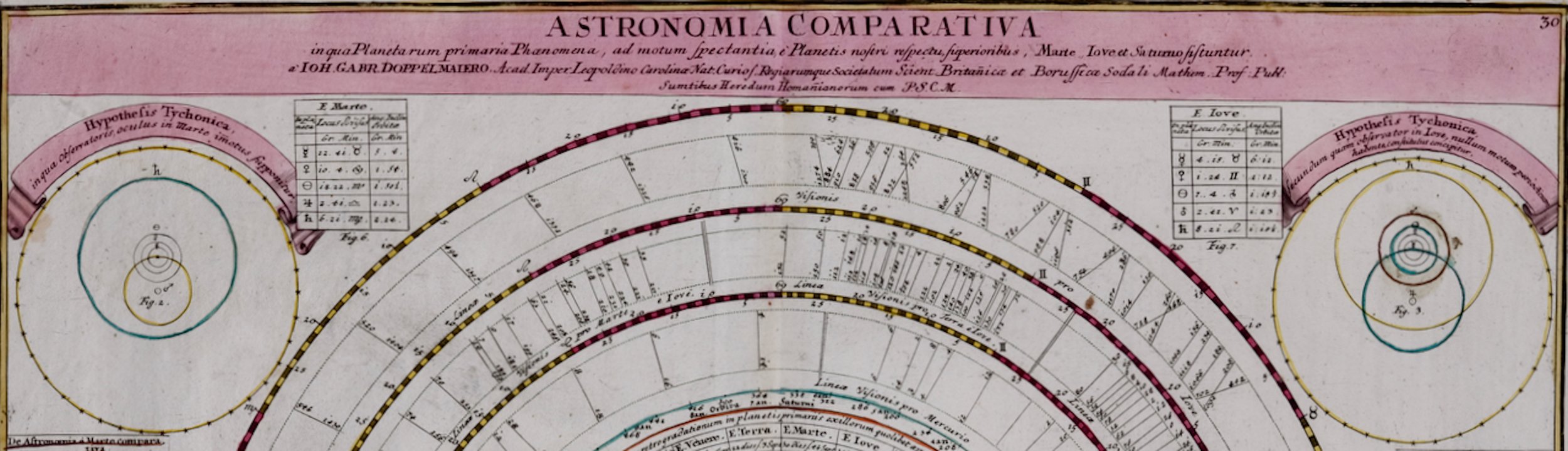
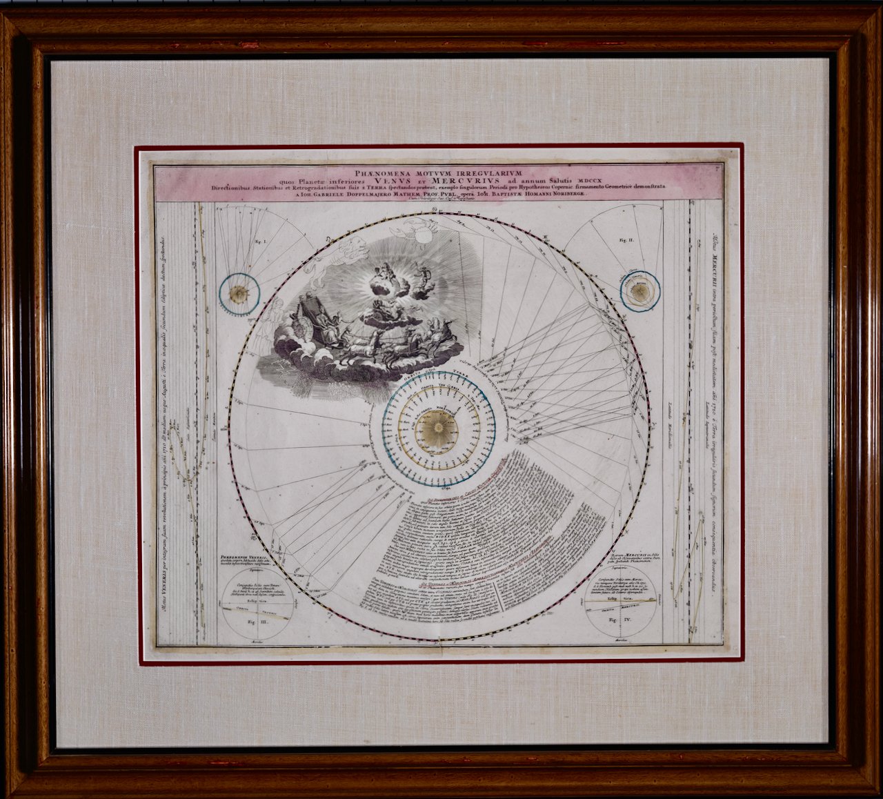
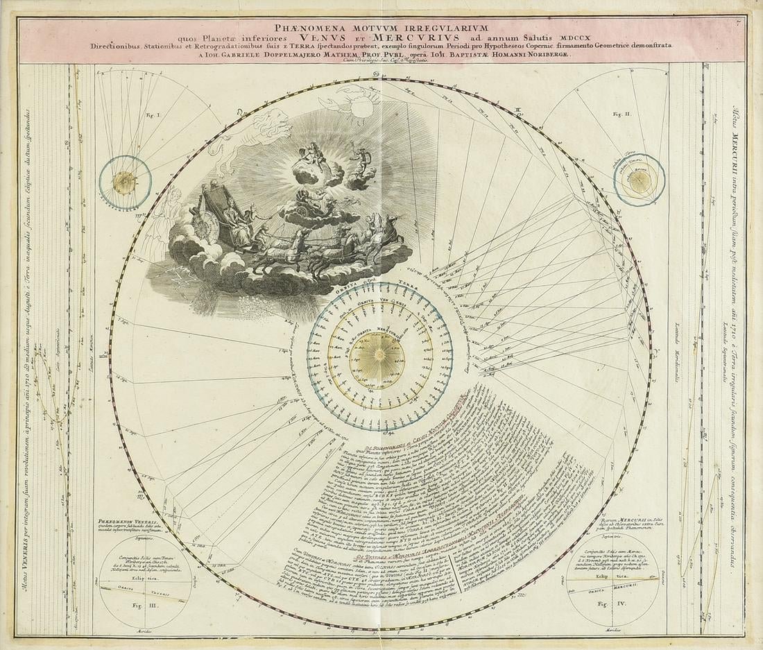
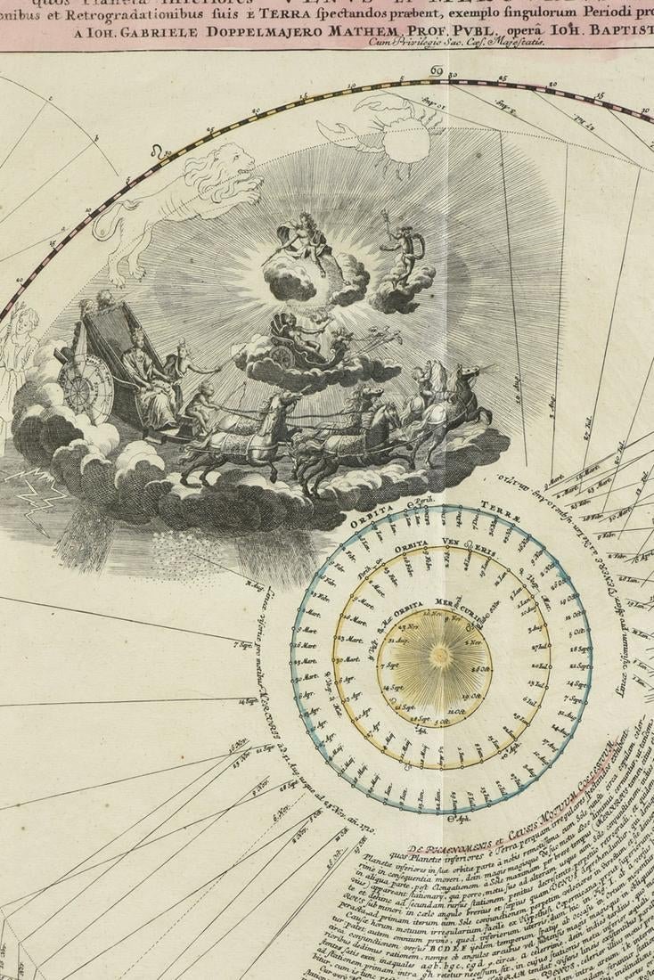
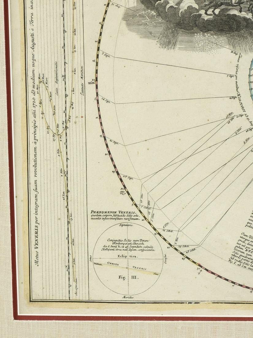
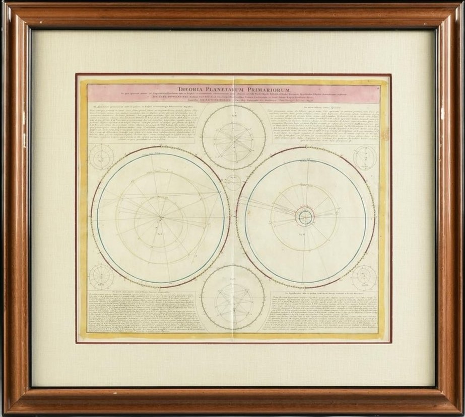
This interesting celestial chart/map depicts movements of the planets based upon the theories of Copernicus and Kepler. Both of these early astronomers promoted heliocentric theories of the solar system in which the planets orbit the sun. They differed in their concept of the shape of the planetary orbits. Copernicus believed the planetary orbits were circular, while Kepler believed planetary orbits were elliptical. Text within the print explain Kepler's theories, as well as Ismael Bullialdus, Seth Ward, and Nicolaus Mercator.
This framed 18th century double page hand-colored engraved celestial map is printed on chain-linked laid paper. It is presented in an attractive polished medium brown-colored frame with contrasting black inner and outer trim. The frame measures 31.25" high by 34.88" wide by 1" in depth. There are a few small frame abrasions. The double mat consists of a beige fabric outer mat and a cranberry-colored inner mat. There is a central fold, as issued with mild separation of the lower fold, but the visible portions of the print are otherwise in very good condition.
Johann Gabriel Doppelmayr (1677-1750) was a famous German geographer and astronomer, who was Professor of Mathematics at the Aegidien Gymnasium in Nuremberg, Germany. He wrote extensively on astronomy, geography, cartography, spherical trigonometry, sundials and mathematical and other scientific instruments and was involved in the production of terrestrial and celestial globes. He was a member of the Royal Society of London and the Berlin and St. Petersburg Academies of Sciences. In the early 1700s, Doppelmayr created astronomical and cosmological plates that were incorporated in atlases published by Johann Baptist Homann (1664-1724), first published in 1712 in Homann’s Atlas von hundert Charten and reprinted in his Grossen Atlas in 1716. They continued to be published after Homann's death by his heirs until 1848. Thirty of these plates were published in the Atlas Novus Coelestis in quo Mundus Spectabilis. Twenty of these plates focused on the cosmological systems of Copernicus and Tycho Brahe, as well as known details of the planets and other bodies in the solar system. The other ten plates focussed on constellations and the locations known stars and comets.
Johann Baptist Homann (1663-1724) was a mapmaker who founded a respected and prolific publishing company, which continued long after his death as Homann Heirs. Homann lived his entire life in Bavaria, particularly in Nuremberg. Initially, Johann trained to become a priest before converting to Protestantism and working as a notary. In 1702, Johann founded a publishing house that specialized in engravings. The firm flourished, becoming the leading map publisher in Germany and an important entity in the European map market. In 1715, Johann was named Imperial Geographer to the Holy Roman Empire by Charles VI and made a member of the Prussian Academy of Sciences. Most importantly for his business, his reputation and contacts gained him imperial printing privileges which protected his publications and recommended him to customers.